ACC students, faculty, and staff present innovative collaboration at the TNRIS forum
Submitted by sydney.pruitt on Tue, 04/05/2022 - 12:48pm
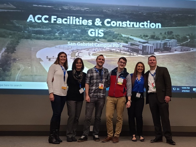
Austin Community College District (ACC) Facilities & Construction (F&C) and Geographic Information Systems (GIS) representatives were invited to present their work on a recent pilot project at the college at the Texas Natural Resources Information System (TNRIS) GIS forum in March.
The project, called "ACC Facilities and Construction GIS: San Gabriel Campus Pilot", was designed to help the college enhance facility construction, management, and maintenance. Guided by F&C and GIS department staff, four ACC students use GIS with high-resolution mapping, enterprise geodatabases, and integrated systems to do the following:
- Track real property assets.
- Streamline facility planning and site selection.
- Inform facility design and construction.
- Monitor and manage utility infrastructure.
- Optimize workspace utilization.
- Analyze and schedule facility maintenance.
- Increased visibility of campus safety features.
- Integrate ACC systems.
As part of a partnership between the F&C and GIS departments, the students were hired as paid interns to develop the project and were supported by staff in those departments. With this successful project behind them, the students are expanding their work to create maps of all 11 ACC campuses.
“Our interns are using leading-edge hardware and software to develop a distributed ACC-wide enterprise GIS. Our innovative program allows our students to graduate with the academic, technical, and professional skills desired by employers,” says Aziz Hussaini, interim vice chancellor of Facilities and Construction. “While most colleges and universities hire outside firms, I am proud of the fact that our program is providing hands-on work and harvesting the training our students receive in ACC’s robust GIS program.”
View their presentation and read more about the next steps here.
For more information on GIS, visit austincc.edu/gis.